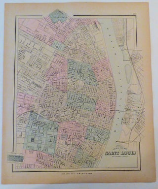
Gray’s New Map of Saint Louis (Map 129 from Gray’s Atlas of the United States)
Philadelphia: O. W. Gray & Son, [1877]. Unbound. Approximately 14” x 17” including the margins. Strong, clear image with hand-coloring. This attractive map of St. Louis shows the streets of the city in detail. Additionally, locations of several historically important sites are shown: Lafayette Park, where Jere..... More