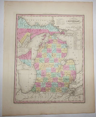
A New Map of Michigan with its Canals, Roads & Distances (Map No. 25 from A New Universal Atlas. . . .)
Philadelphia: Carey & Hart, 1841. Unbound. Approximately 14” x 17.5” including the wide margins. Includes an inset map showing the western part of the Upper Peninsula and a distance table for Detroit Steam Boat Routes. Strong, clear image with attractive hand coloring. Very light soiling. This very attractive..... More